
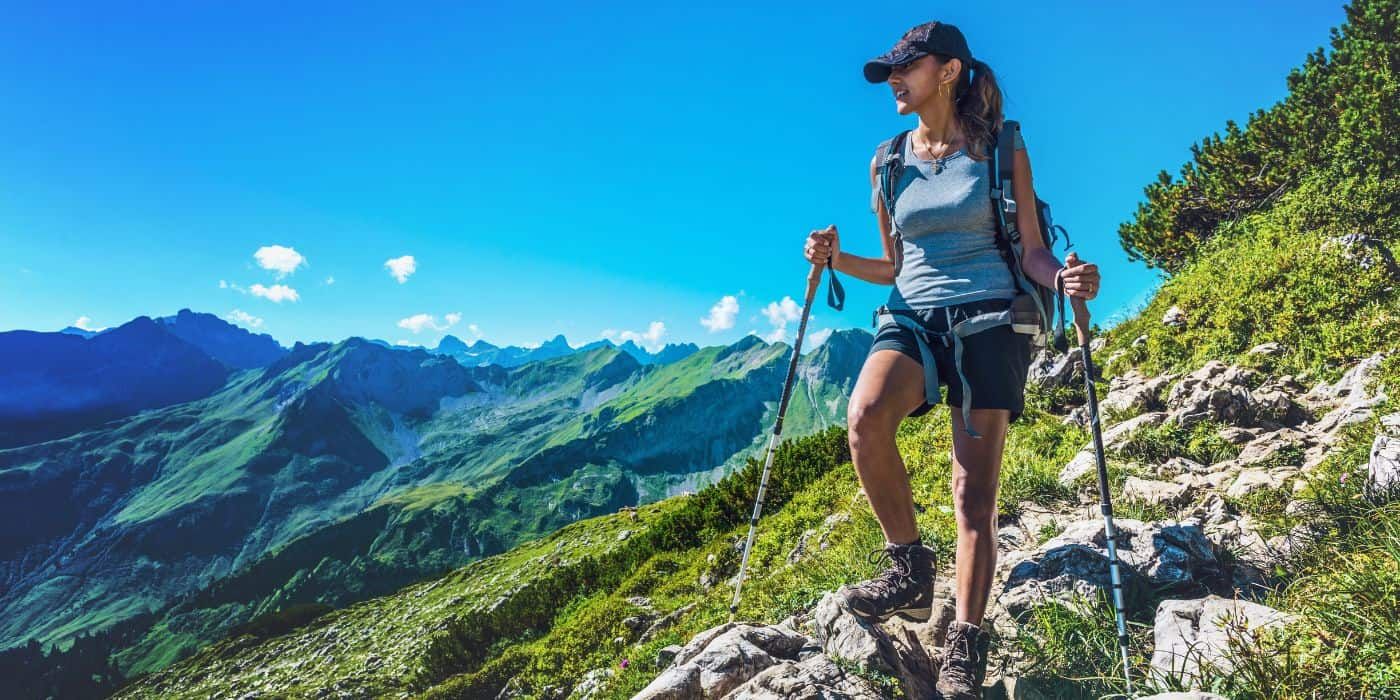
Spring hikes in Italy offer something that becomes increasingly rare in summer: quiet trails, landscapes in full bloom, and ideal temperatures for long walks without the intense heat.
Between the end of winter and the beginning of summer, many mid-altitude routes reopen after the snow, coastal paths fill the air with the scent of broom and wild rosemary, and the first alpine flowers begin to appear in mountain valleys.
With temperatures often ranging between 15 and 22°C in hilly and coastal areas, spring is the perfect time to tackle elevation gains and long-distance walks without the humidity and, above all, without the crowds of the high season.
From mid-March to mid-June, it’s the ideal moment to lace up your hiking boots, pack your backpack, and set off.
Let’s discover together some of the best trails to explore in spring in Italy, when the landscape is at its most vibrant and hiking routes still retain their authentic rhythm.

Spring hikes in Italy: where to enjoy the route without the crowds?

Italy boasts hundreds of hiking routes, but not all of them are ideal in spring. Some remain snow-covered until late in the season, while others become too hot as early as May.
We selected these particular trails because they:
- are located at elevations that are well suited for spring hiking
- cross landscapes that are especially spectacular during this season
- combine nature, history and originale villages
- allow flexible stages or shorter day hikes
From the Alpine north to Imperial Puglia, these routes show how spring transforms Italian trails into very different experiences: flowering forests, sunlit plateaus, rocky pastures and historic paths that link castles and medieval villages.
The trails we will explore are:
- Cammino Balteo – Aosta Valley
- San Vili Trail – Trentino Alto Adige
- Sirente Velino Park – Abruzzo
- Cammino dei Borghi Silenti – Umbria
- Bellavista Loop in the Serre Regional Park – Calabria
- Cammino Federiciano – Puglia
6. Cammino Balteo, Aosta Valley

The Cammino Balteo is one of the most surprising spring hiking routes in Italy if you are looking for varied landscapes and flexible stages.
It unfolds in a large loop across the lower and middle Aosta Valley, following the course of the Dora Baltea and branching into its first side valleys, from the Lys Valley to the Valdigne. The route resembles a ramified tree, much like the river basin that shapes this territory.
The trail is divided into 23 stages, each lasting between 4 and 6 hours and covering distances from 8 to 20 kilometers. Altitudes range from 350 to 1,900 meters, with elevation gains between 200 and 1,300 meters, although most stages remain moderate. This makes it a mid-mountain itinerary accessible even to non-athletes, provided you have basic fitness and are comfortable with uphill sections.
Route highlights: The terrain alternates between forest paths, dirt roads and short paved stretches, and every stage ends in a village served by public transport and offering accommodation. This makes it easy to adapt the itinerary, shorten longer stages or stop overnight without complicated logistics.
Along the way you will encounter places rich in character, such as the village of Donnas, known for its ancient gateways and long-standing wine tradition, or the small hamlet of Chemp (Perloz), where an open-air museum displays evocative wooden sculptures among the houses.
Panoramic viewpoints are plentiful. Among the most striking are Ozein, overlooking Mont Blanc and the Grivola, and the vineyards surrounding the Castle of Aymavilles, one of the symbols of Aosta Valley’s wine culture.
Landscape: In spring, the Cammino Balteo reveals one of its most beautiful faces.
Beyond the Forte di Bard, fresh green woodlands begin to bloom with wood anemones and dog’s tooth violets, while at mid-altitude you will encounter cyclamen and downy oaks, plants adapted to the warmer slopes of the Adret.
Around Perloz, the peony (Paeonia officinalis) makes its appearance, while in the Côte de Gargantua Nature Reserve the vegetation becomes drier and more rugged, with artemisia, dwarf juniper and heather growing on rocky moraines.
Difficulty: Easy to moderate
How to get there: Official start and finish in Pont-Saint-Martin, reachable by car via the A5 motorway (Pont-Saint-Martin exit) or by train on the Turin–Aosta line (Pont-Saint-Martin station).
Local tip: On Stage 5 (Arn–Challand), do not follow the main road toward Verrès immediately after crossing the Arn bridge. The trail climbs steeply through chestnut woods instead.
5. The San Vili Trail, Trentino-Alto Adige

The San Vili Trail is one of Trentino’s great historic routes: 107 kilometers from Trento to Madonna di Campiglio, with over 3,700 meters of total elevation gain.
It follows an ancient Roman road that, according to tradition, was walked in the 15th century by Saint Vigilius, the patron saint of Trento. Today it is a multi-stage itinerary, but if you are looking for accessible and scenic spring hikes in Italy, there is a perfect central section for a half-day walk: from Tavodo to Stenico, less than two hours on foot.
Route highlights: Start from the Church of Santa Maria Assunta in Tavodo, following the “SV” waymarks. After a few hundred meters, the asphalt gives way to a forest trail, initially steep and then gradually gentler.
Once past the woodland area, you reach Sclemo, then cross open meadows toward Seo, where the view opens onto the sunlit fields of the Bleggio plateau.
One of the most fascinating sections is the BoscoArteStenico trail, a Land Art route immersed in the forest: among tree trunks and clearings, you will encounter wooden sculptures depicting animals and legendary creatures, a surprising open-air museum that blends seamlessly with the surrounding nature.
Landscape: The landscape shifts step by step along this section of the trail. You move through the holm oak woods of the Valle dei Laghi, then into deciduous forests and finally onto the slopes that herald the Brenta Dolomites.
In spring, the undergrowth fills with pre-Alpine blooms such as anemones and primroses, while the meadows of the Bleggio plateau open into bright, sweeping views across the countryside.
Difficulty: Moderate
How to get there:
– From Madonna di Campiglio (north): reachable by car or bus from Trento or Pinzolo; the trail starts near the Church of Santa Maria Antica in the historic center.
– From Trento (south): departure directly from the city; the route crosses Monte Terlago, Covelo and the Valle dei Laghi heading north.
– Intermediate access – Ranzo (Vallelaghi): drive past Terlago, continue toward Ciago and follow signs for Lon, Margone and Ranzo; the trail (SAT marker 613) begins near the village.
– Intermediate access – Tavodo (Giudicarie): convenient starting point for the Stenico section, reachable by car or bus, with parking available.
Local tip: There is a lower route (more rural) and a higher route (more mountainous). One of the most distinctive stretches is the Bosco Arte Stenico section.
4. Sirente Velino Regional Park: Fonte dell’Acqua to Lake Tempra Loop

In the heart of the Sirente Velino Regional Nature Park, the loop starting from Rocca di Mezzo is one of the most captivating routes to explore in spring.
It follows a section of the Great Loop of the Park (MTB 200) and allows hikers to experience a vast and still largely untouched landscape, where plateaus, forests and limestone cliffs shape an environment of remarkable natural beauty.
Established in 1989 and covering more than 54,000 hectares, the park protects a mosaic of ecosystems that in spring awaken with vibrant colors and clear light that highlights the geometry of the mountains. The loop trail offers the chance to experience this environmental variety in just a few hours, alternating wooded stretches, panoramic clearings and passages across open highlands.
Route highlights: Starting from Rocca di Mezzo, the trail immediately climbs along a short rocky stretch that introduces the landscape of the park. After passing the Lu Campicciole picnic area, the path becomes smoother and enters the forest, with pleasant descents leading to Piano di Iano, a wide plateau at about 1,000 meters above sea level.
From here, the view opens onto the northern face of Mount Sirente, a majestic mountain whose rugged profile recalls the shape of the Dolomites. The route then continues toward the Pagliare of Tione degli Abruzzi, small rural settlements connected to the pastoral traditions of the region.
After a short and lightly trafficked paved section, the trail re-enters the woods and reaches Lake Tempra, a small body of water believed to have meteoritic origins. The Secinaro and Tione area has in fact been recognized as Italy’s first documented meteorite impact site.
The return toward Rocca di Mezzo passes by Chalet Sirente, a useful stopping point for rest and water, before continuing through Fonte Anatella and Vado della Forcella, and finally descending to complete the loop.
Landscape: The landscape of the Sirente Velino area constantly shifts between environments: deciduous forests, bright clearings and high plateaus that seem suspended between sky and mountains.
In spring, wildflowers typical of the central Apennines brighten the meadows, while shaded sections still hold the cool moisture of the forest floor, with mosses and vegetation preserving the breath of the winter that has just passed.
The contrast between the wide grassy basins and the rocky walls of Mount Sirente creates a landscape of striking natural balance, where the silence of the park and the vastness of the surroundings make the hike particularly evocative.
Difficulty: Moderate
How to get there:
– From Rome: A24 motorway, exit Tornimparte/Campo Felice, then SS 696 toward Rocca di Mezzo.
– From L’Aquila: S.R. 5 Bis (former SS 5 Bis), then SS 696.
– From Pescara, Sulmona, Avezzano: A25 motorway, exit Aielli-Celano, then SS 696.
Rocca di Mezzo is connected by bus to L’Aquila, Avezzano and Rome. The nearest railway stations are Celano-Ovindoli and Avezzano.
Local tip: Stop at Piano di Iano for a panoramic break before the next climbs, and carry extra water, as refill points are limited. In spring, start in the late morning to avoid residual humidity in the more shaded sections.
3. Cammino dei Borghi Silenti, Umbria

The Cammino dei Borghi Silenti winds along the northern slopes of the Monti Amerini, in southwestern Umbria, one of the least-visited areas of the region.
It is a circular route divided into five stages, designed to be walked over several days and to reveal a side of Umbria far from the most crowded tourist circuits, a landscape shaped by deep forests, white country roads and small medieval villages that have remained almost unchanged over time.
The name of the trail is no coincidence: here, silence becomes part of the experience. You can feel it in the holm oak and chestnut woods, in the stone alleyways of the villages and along country roads where the rhythm of travel finally slows down.
Route highlights: The trail embraces Monte Croce di Serra, the highest peak of the Monti Amerini at just under 1,000 meters, a panoramic point from which the view stretches across gentle hills and untouched rural landscapes.
Along the way, the route connects several authentic villages:
_ Tenaglie, the starting point with its proud castle;
_ Guardea;
_ Santa Restituta, with narrow alleys and stone houses;
_ Toscolano, known for its ancient circular structure;
_ Melezzole, surrounded by chestnut groves;
_ Civitella del Lago, overlooking Lake Corbara with turquoise views over the water below.
The journey also passes through places of remarkable natural and spiritual charm, such as the Forello Gorges carved by the Tiber River, the Hermitage of Pasquarella hidden among the mountains, and the Etruscan necropolis of San Lorenzo near Montecchio.
Landscape: The landscape alternates between holm oak, oak and chestnut forests, rolling hills and small stone villages emerging from the greenery.
In spring the trail becomes especially captivating: in the woods you can spot wild orchids, violets, primroses and anemones, while in open fields rapeseed and broom paint the countryside yellow and poppies add bright red touches along the edges of the white gravel roads.
Difficulty: Moderate
How to get there:
Start in Tenaglie (a hamlet of Montecchio, province of Terni), in Piazza Vittorio Emanuele II.
– By train: get off at Orvieto station (Rome–Florence line), then take a local bus to Tenaglie.
– By car: A1 motorway exit Attigliano, then follow SP87 and SP88 to your destination.
Local tip: Plan your stages flexibly so you can stop in lesser-known villages, and carry sufficient water supplies, some sections cross uninhabited areas. In spring, walk during the central hours of the day to enjoy the blooms and the soft light over the Umbrian hills.
2. Serre Regional Park: Bellavista Loop, Calabria

At the heart of the Calabrian Serre, the Bellavista Loop passes through one of the most valuable natural settings in the region: the Marchesale Biogenetic Nature Reserve, part of the European Network of Biogenetic Reserves and recognized as a Site of Community Importance (SCI).
The trail lies between the municipalities of Acquaro and Arena, within a protected area that plays a key role as an ecological corridor and in the conservation of native plant species and local ecotypes.
Route highlights: The route begins in Gallone-Fanelli, in the Piani di Acquaro, and follows a circular trail that crosses forests, streams and panoramic clearings.
After an initial climb through towering beech trees, the path runs alongside a stream and continues into dense woodland where sunlight filters gently through the canopy.
One of the most evocative sections follows an irrigation canal framed by granite formations, about four hundred meters immersed in an almost primordial landscape.
Landscape: The landscapes of the Serre are rich and surprising. In spring, the shrub vegetation bursts with colors and scents: broom, heather, strawberry tree, myrtle, phillyrea, rockrose, mastic and holly line the trail.
From the panoramic viewpoints, the view stretches all the way to the great coastal plains, from the plain of Gioia Tauro to the plain of Lamezia Terme, while cultivated slopes and forests climbing toward the interior create the distinctive scenery of Calabria’s mountain landscapes.
Difficulty: Moderate
How to get there:
– From the A3 Salerno–Reggio Calabria motorway, exit at Serre, then follow SP4 toward Acquaro-Dinami to Gallone-Fanelli.
– Alternatively, from Boscoreggio (municipality of Dinami) via SP9.
– Or from SP58 toward Arena, near the ruins of the Norman aqueduct, following signs for Bove and then Gallone.
Local tip: Carry sufficient water despite the fountain along the route, and allow time for the initial panoramic stop, the view over the two plains is one of the most powerful moments of the entire loop.
1. Cammino Federiciano, Puglia

Seven stages, 130 kilometers through the heart of Imperial Puglia.
The Cammino Federiciano connects Gioia del Colle to Trani via Castel del Monte, following a route that weaves together Swabian history, Murgia landscapes and ancient drovers’ roads. It is one of the most distinctive spring hiking routes in southern Italy, where the landscape still speaks the language of Frederick II.
Route highlights: Start from the Castle of Gioia del Colle, originally built in the Byzantine era and later transformed during the Norman-Swabian period. From here the trail crosses Cassano delle Murge and the historic town of Altamura, before opening onto the rupestrian landscape of Gravina in Puglia, where caves and deep canyons reveal traces of very ancient settlements.
Among the most evocative stops is the Rocca del Garagnone, known as the “invisible castle”. Today only ruins remain among the fields of the Murgia, yet they still evoke the defensive system that once controlled these lands along the ancient Via Appia.
One of the most memorable moments comes when Castel del Monte appears on the horizon. The famous octagonal fortress commissioned by Frederick II rises from the plateau like a true crown of stone.
The final stretch leads toward the sea. The journey ends in Trani, overlooking the Adriatic, where the magnificent Cathedral of San Nicola Pellegrino stands facing the waves just across from the Swabian Castle.
Landscape: The Murgia landscape is defined by wide open spaces: rocky pastures, wheat fields, winding ravines known as lame, and ancient transhumance routes.
In spring the plateau turns a vibrant green and the scent of wild thyme and mint accompanies every step. Among the grasses you may spot wild orchids, while overhead the lesser kestrel, a symbol of the region’s biodiversity, circles above the karst landscape.
Along the route you will also encounter historic masserie, pastoral shelters known as jazzi, rural stone huts (pagliari) and ancient cisterns, traces of an agricultural and pastoral culture shaped over centuries by emperors, farmers and shepherds.
Difficulty: Easy to moderate
How to get there:
– Start in Gioia del Colle, easily reachable by train (Bari–Taranto line) or by car via SS100 from Bari.
– End in Trani, connected to the Adriatic railway line (Bari–Foggia).
Local tip: Plan your stages in advance during the spring months, carry sufficient water for the more isolated stretches of the Alta Murgia, and visit Castel del Monte early in the morning, when the light enhances the limestone and visitor numbers are lower.
About the author
Written on 11/03/2026
Flavia Cantini
Freelance Content Writer with over a decade of specialized experience in tourism, culture, and creative/artistic activities. I assist magazines, web agencies, and end clients in managing blogs and crafting standout articles

Flavia Cantini
Spring hikes in Italy mean fragrant trails, mild temperatures and wide-open views without the summer crowds.